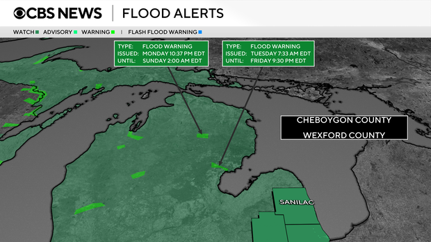
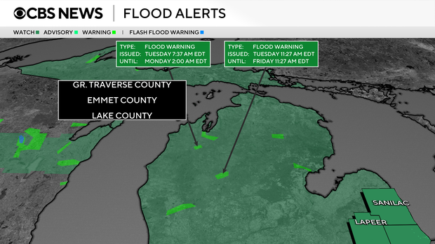
Flood watch issued for all of Southeast Michigan through Thursday

A flood watch has been issued for all of Southeast Michigan, to be in effect from 8 p.m. Tuesday through late Thursday night.
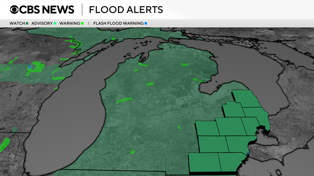
The issued that alert Tuesday, on top of already saturated ground may result in excessive runoff into rivers, creeks, streams and low-lying areas. The storms are part of a severe weather system that is affecting the Great Lakes and the Midwest region.
During the last 10 days, the NWS said, most of Southeast Michigan has seen 1.5 to 4.5 inches of rainfall. This saturated the soil before the "main spring green up" began.
Multiple rounds of showers and thunderstorms are in the forecast Tuesday through Thursday, which could bring totals of anywhere from 1 to 4 inches of new rainfall to a given area, depending on the storm track.
"Those living in areas prone to flooding should be prepared to take action should flooding develop," the NWS said.
For safety reasons, the NWS says to stay out of floodwaters. Should they develop, under the water, such as electric wires, washed-out roads or chemicals.