Periods of rain Sunday as temperatures drop in Philadelphia region. Here's the weather forecast.
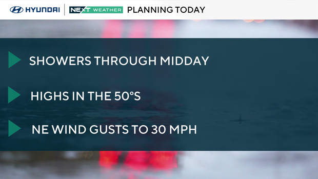
Keep the umbrellas and coats close today. The warmth we enjoyed last week is gone, replaced with cloudy and breezy conditions and highs only in the 50s.
Expect periods of rain showers to continue through midday.
NEXT big weather changes
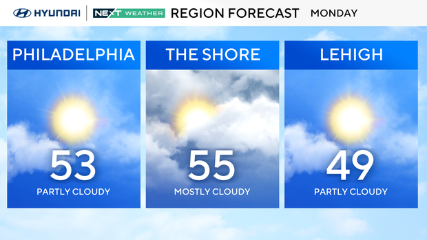
On Monday, we bottom out with highs well below average in the low 50s. As a secondary cold front arrives there may be a spotty rain shower in the morning and some mixing in the Poconos. Otherwise it'll breezy with partly cloudy skies.
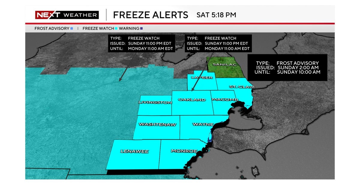
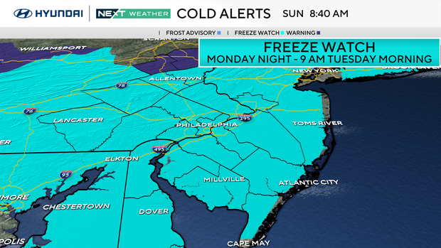
Tomorrow night through Tuesday morning a Freeze Watch will be in effect for the entire area. If you planted any vulnerable plants or flowers, be prepared to protect them from near freezing temperatures and frost.
Tuesday remains chilly but sunny with highs in the upper 50s.
By Wednesday we bounce back into the 70s and remain there through Saturday.
Rain chances are limited for the week ahead. Unfortunately, that means our already moderate drought will continue to worsen.
Here's the 7-day forecast:
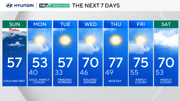
Sunday: Cold and wet. High 57.
Monday: Cold, partly cloudy. High 53, low 40.
Tuesday: Freezing morning. High 57, low 33.
Wednesday: Isolated shower. High 70, low 46.
Thursday: Nice day. High 77, low 49.
Friday: Partly cloudy. High 75, low 55.
Saturday: Mostly cloudy. High 70, low 53.