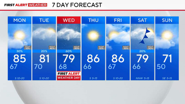
Storms clear by sunrise; next severe weather threat builds through midweek

Overnight storms will lose their steam and clear by sunrise, and we are already looking forward to the next chance of storms.
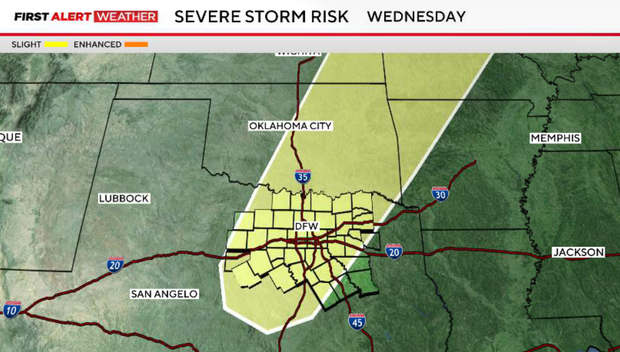
There will be a few scattered showers and storms on Monday and Tuesday, but the next threat of severe weather moves in on Wednesday
The storm zone includes a majority of the I-35 corridor across North Texas. Heavy rain, strong winds, damaging hail, and an elevated tornado threat are possible.
On Monday afternoon and evening, there is another threat of severe weather for counties to the west of the metroplex. This risk is conditional and extremely dependent on environmental factors and if storms can break a capping inversion. Tuesday will be the same way.
A potent upper-level low-pressure system moves across the area on Wednesday, increasing the risk for more storms that have the chance of turning severe. All modes of severe weather will be possible.
Moving into this upcoming week through the next weekend, a warm, muggy, breezy and stormy stretch of weather this week will be followed by a significant cold front by the weekend.